
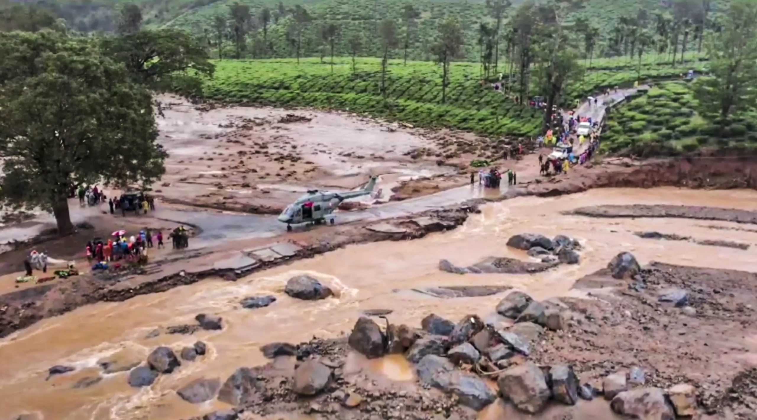
The devastating landslides in Kerala’s Wayanad district which have led to over 250 deaths, have brought to the forefront the need for improved disaster prevention and management in India.
Let us understand what landslides are and what is being done by certain organisations, using aerial and satellite data including landslide atlas, to map landslide-prone districts in the country and share the latest research findings in this field.
What are landslides?
The frequently used definition of landslide is “a movement of mass of rock, earth or debris down a slope”.
Landslides can be triggered by rainfall, undercutting of slopes due to flooding or excavation, earthquakes, snowmelt, overgrazing by cattle, terrain cutting and filling, and excessive development.
Rainfall is the natural triggering factor for occurrence of landslides. Rainfall-induced landslides are the result of the combined action of water on topography, geology, soil, and vegetation.
Why is India prone to landslides?
India is a country with varied physiographic and climatic conditions. About 0.42 million sq. km or 12.6 per cent of land area, excluding snow-covered area, is prone to landslides.
In India, landslides mostly occur in the monsoon season. The Himalayas and Western Ghats are highly susceptible to mass movements due to hilly topography and heavy rainfall.
Why are Western Ghats more vulnerable?
The vulnerability of inhabitants and households is more significant in the Western Ghats due to the very high population and household density of the region, especially in Kerala, even though fewer landslides happen here than in the Himalayan regions.
What is a landslide atlas?
A landslide atlas illustrates the overall landslide scenario in a country and includes important research findings in the field of landslide hazard.
The “Landslide Atlas of India” has been generated by National Remote Sensing Centre (NRSC), Hyderabad.
The atlas provides information about landslides in Landslide Provinces of India including damage assessment of specific locations
NRSC is one of the centres of the Indian Space Research Organisation (ISRO) that provides satellite data, products, applications, and services for remote sensing and geospatial technologies. It manages data from aerial and satellite sources. It is an Indian Remote Sensing Programme in existence since 1988.
Why does ISRO have a landslide atlas?
The Disaster Management Support (DMS) Programme of ISRO addresses various aspects of natural disasters in the country, using space-based inputs. Under this programme, ISRO has been actively working on landslide disaster response and mitigation.
Satellite data and derived information have been provided for major landslide disasters that have occurred across the country. Damage assessment for major landslide disasters was carried out using satellite data and aerial images and value-added products are provided to stakeholders.
What is the landslide inventory database?
The landslide atlas provides information about landslides in Landslide Provinces of India including damage assessment of specific locations.
The database covers landslide vulnerable regions in 17 states and two Union Territories of India in the Himalayas and the Western Ghats. The database had three types of landslide inventory – seasonal, event-based and route-wise for the 1998-2022 period.
Seasonal inventory: It contains a pan-India landslide database corresponding to the 2014 and 2017 rainy season in India.
Event-based inventory: It contains details of some of the major triggering events such as Kedarnath and Kerala disasters, and Sikkim earthquake as well as a few large valley-blocking landslides.
Route-wise inventory: It contains details of landslides along selected routes of tourism and pilgrimage.
What is the ranking of districts based on the database?
The database was used to rank 147 districts in 17 states and two Union Territories of India for their exposure to landslides in terms of key socio-economic parameters.
Rudraprayag district in Uttarakhand state is the number one-ranked district. It has the highest landslide density in India.
What is landslide risk exposure?
Landslide exposure analysis was carried out in the mountainous areas.
The occurrence of landslides in an area is due to the interplay of favourable terrain parameters such as slope, lithology, topography and land use which trigger landslides in response to rainfall or earthquake events.
The Northwest Himalayas account for 66.5 per cent of landslides in India, followed by the Northeast Himalayas at 18.8 per cent, and the Western Ghats at14.7 per cent.
Images are for reference only.Images and contents gathered automatic from google or 3rd party sources.All rights on the images and contents are with their legal original owners.
Comments are closed, but trackbacks and pingbacks are open.